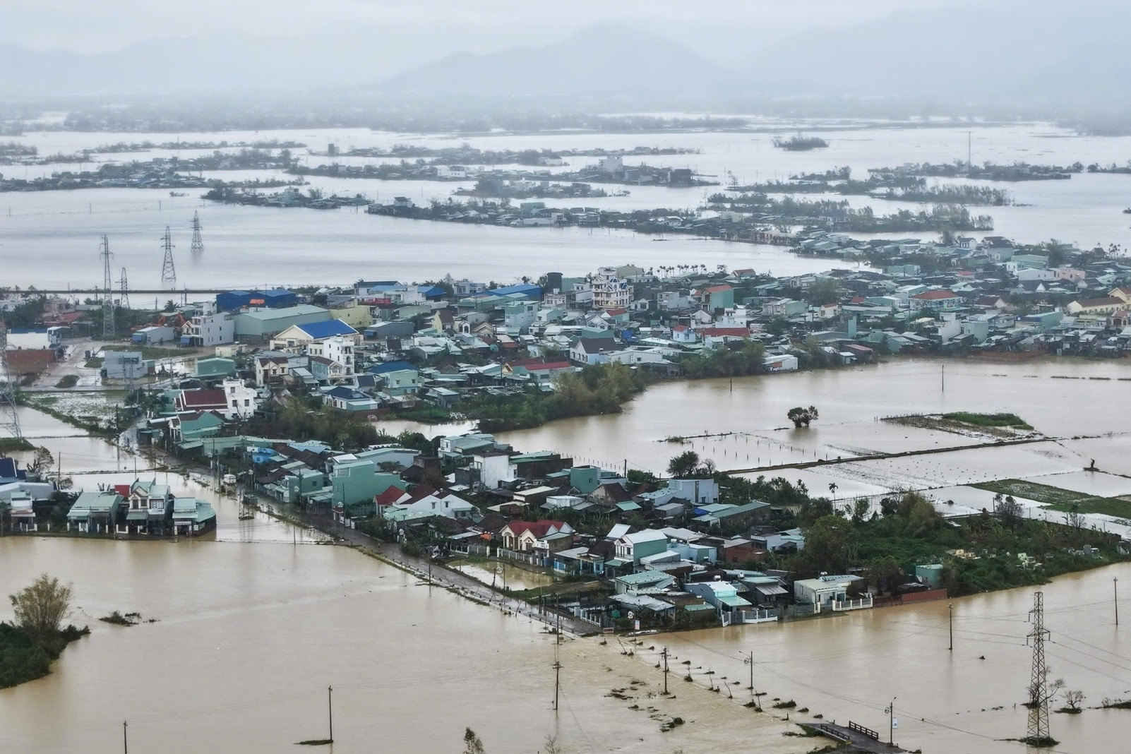
Severe flooding has inundated homes, submerged thousands of cars in Nha Trang, and left entire communities in Khanh Hoa and Dak Lak isolated. Emergency teams are racing to deliver life jackets and supplies by air.
A powerful surge of cold air combined with easterly winds has brought extreme rainfall across central Vietnam, especially in the provinces from Quang Tri to Khanh Hoa. In former Phu Yen alone, rain gauges recorded between 1,000mm and 1,200mm of rain in a very short period.
On the afternoon of November 20, Hoang Phuc Lam, Deputy Director of the National Center for Hydro-Meteorological Forecasting, delivered an urgent assessment on the ongoing crisis.
According to Lam, the current flooding across the South Central region has reached a very dangerous level. Overnight and into the morning of November 20, three rivers reached flood crests surpassing historical records. Specifically, the Ky Lo River (Dak Lak) exceeded the historic 2009 level; the Ba River (Dak Lak) topped its 1993 record; and the Dinh River in Ninh Hoa (Khanh Hoa) overtook its 1986 peak.
At present, the flood levels on the Kon River (Gia Lai), Ky Lo, Ba, Dinh (Ninh Hoa), Cai River (Nha Trang), and Cai River (Phan Rang) remain extremely high - between 0.2m and 2.12m above alarm level 3. Meanwhile, the Krong Ana and Srepok Rivers (Dak Lak) are just below level 3.
In the next six hours, the Ba River is expected to remain above level 3 - equaling the historic flood of 1993 (5.21m) - before slowly receding. Other rivers are expected to gradually decrease as well.
Lam highlighted several anomalies in this flood event. The rains have been intense and prolonged, lasting from the night of November 17 to now, following multiple earlier storms in October and early November. While most of the rainfall in recent months targeted the northern central region, this system shifted sharply south.
The combination of a cold front with disturbances from the east created pockets of exceptionally intense rainfall in short spans of time. Regions like Son Thanh Tay, Son Thanh Dong, Hoa My Tay, Son Long, Son Dinh, and Song Hinh recorded between 1,000mm and 1,200mm.
Due to repeated downpours and earlier floods, many hydropower reservoirs were forced to release water continuously, pushing base water levels on local rivers dangerously high. As a result, several rivers surged to historic flood levels again, compounding the devastation.
Heavy rain continues, risks persist
Lam warned that torrential rains will persist throughout the day and night in the South Central region, with the heaviest impact forecasted for eastern Dak Lak and northern Khanh Hoa. Rainfall is expected to range between 100mm and 200mm, with localized areas receiving more than 350mm.
Such rainfall will keep water levels above alarm level 3 in many rivers, heightening the risk of floods, flash floods, and landslides in the coming hours.
Floodwaters on the Cai River (Nha Trang) have peaked and are receding, while levels on the Dinh (Ninh Hoa), Cai (Phan Rang), and Krong Ana (Dak Lak) Rivers are still rising. Rivers such as Huong and Bo (Hue), the Kon River (Gia Lai), and others from Da Nang to Khanh Hoa are slowly declining.
After November 21, rainfall is expected to ease and shift northward. Floodwaters in Dak Lak and Khanh Hoa will begin to recede. However, rainfall will likely intensify in areas like Quang Ngai, Da Nang, and Hue.
Bao Anh